
I’m on a quest to explore the creeks and waterways of Vancouver, Burnaby, and New Westminster. First, I need to understand how the topography of my neighbourhood determines the flow of water and the formation of streams.
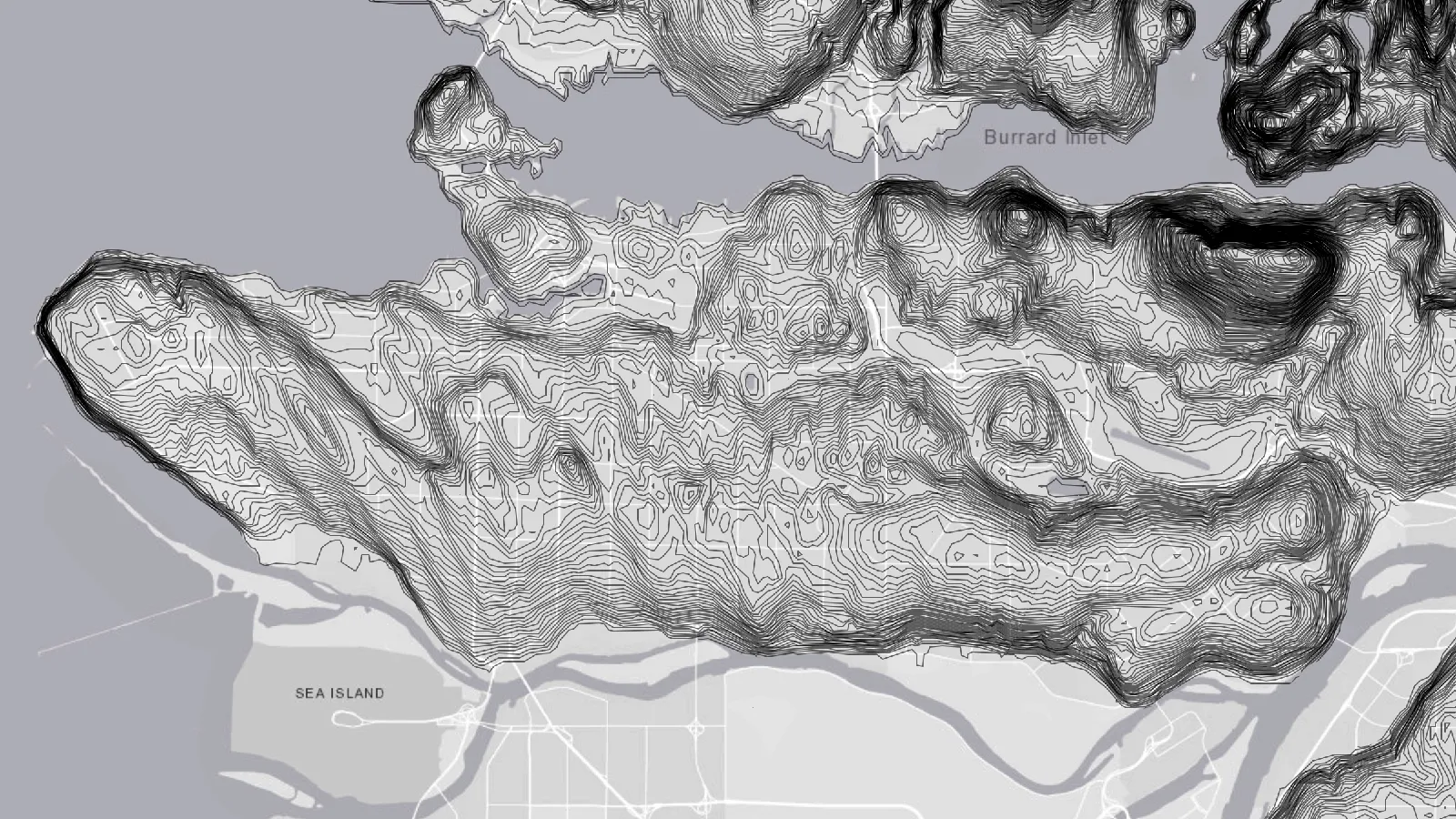
A topographic map of the Burrard Peninsula.
Three main topological features define how water flows in the Vancouver-Burnaby-New West area:
- a chain of hills running along səl̓ilw̓ət (Burrard Inlet) from East Vancouver to Coquitlam, including Capitol Hill and lhuḵw’lkuḵw’áyten (Burnaby Mountain);
- a ridge extending from t̕θəcəliʔqʷ (UBC) to sχʷeyəməɬ (New Westminster) along the southern half of the peninsula, with peaks at Little Mountain and the Metrotown area; and
- weirdly enough, a barely perceptible incline between Nanaimo Street and Renfrew Street in East Vancouver.
These features divide the Burrard Peninsula into four watersheds, which determine where a falling raindrop will flow
- north, into səl̓ilw̓ət (Burrard Inlet),
- northwest, into False Creek/English Bay,
- south, into stal̓əw̓ (the Fraser River), or
- east, through Still Creek, Burnaby Lake, and the Brunette River, before returning west via stal̓əw̓ (the Fraser River).
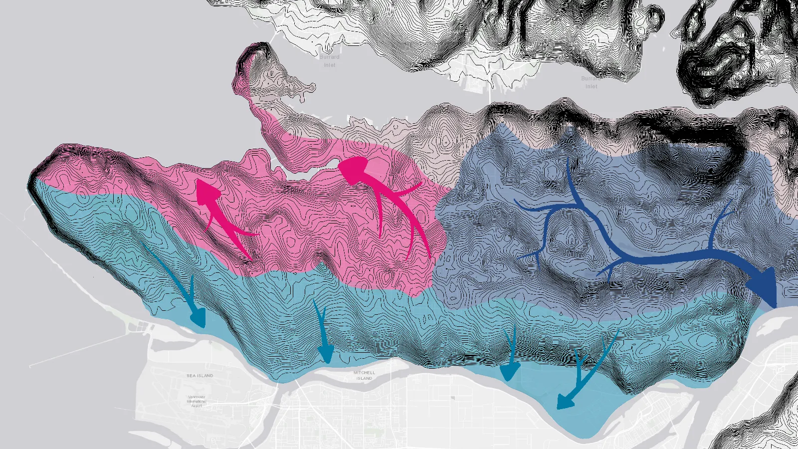
The main watersheds of the Burrard Peninsula.
(More detailed watershed maps can be found on the websites of the City of Vancouver and the City of Burnaby.)
Most of the historic streams of Vancouver have been developed over, so rainwater now is mainly conveyed through storm drains and groundwater. In contrast, Burnaby still has plenty of streams carrying rain through its watersheds.
I’ll be exploring these streams and attempting to trace them from source to mouth. Stay tuned for more!